Friday, December 10, 2010

DAY 8 Finally Back On The Water

A "good morning", rises me from my tent.   Officer Dawn McDonough greets me this morning, "just thought I would check up on ya, didn't want you to freeze out here."  I ask her if there is a place I can charge stuff, and that I would departing this afternoon with the outgoing tide.  She unlocks this cute little building near my tent that seems to be some kind of ticket office when the ferry is running.  No heat, but it has power!  It is also out of the wind.


While powering up and blogging with very cold hands, try to type sometime with cold hands, not easy.  I am preparing to depart,  Now it takes me quite a bit longer to depart with all this extra stuff.  Checking again for all the gadgets and cords, etc...  I also fill all my water bottles, because I do not when I will get to fresh water again.  I use indoor potty, twice.  I call Sally O'Bryne for the most up to date info on the Pea Patch Island rookery but due to poor service that day I will need to update this blog at a later time.

Departure time is set for 230 pm, actual time of departure was 330 pm.  When I am getting ready to leave a sharpshin flies overhead and there are seven oldsquaw (longtails?) in the cove.  Several flocks of canada geese fly over as well (140 plus total)

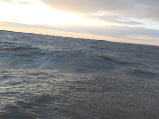
I struck out with the idea of keeping the shoreline within a 100 yards, but this wind was now from the NW, and I quickly found that if I used it to my advantage I could actually sail the canoe.  I had it loaded heavy up front, so not to have a high front in the wind, so the back was a little higher and would catch the wind and act like a sail, all I had to do was keep paddling on the opposite side of the push, and then "come about" and paddle the other opposite side.  That meant I tacked my way up the coastline and since my destination was to slightly to the Southwest I left myself go that way more, getting me about 250 yards from shore from time to time.


With the winds there were a few whitecaps and the boat easily cut through and popped over the crests.  There were only a few swells that gave me a drop over feeling!  WHAT A RIDE!!

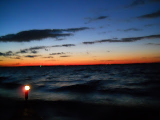
It was dusk and I received a phone call from my friend Mr. Beltz.  It was good timing because I was just pondering laying up prior to the Nuclear Power Plant, of going for it.  After a quick chat, I decided wind and weather were in my favor and this is the time to make "hay", so to speak.  So, I shored up on this exposed sand bar with low tide to put on my running lights and don my headlamp.  There were numerous gulls using this bar.


My vessel looked really cool with its lights on.  I get a snack and chug some water,  shove off for my destination beyond the power plant.  I head out very wide wanting to miss it completely.  I am actually following a path the moon is illuminating for me, WOW!  It is really a path of light reflecting on the surface, at this point I am a serious distance from shore, I got this moonlit path in front, the lights of this enormous cooling tower vessel to my left, and the occasional tanker far to my right.  Things are going very, very, well!


At some point in the middle I turn on my cell phone to see if I get signal.  I do, so I give Sally a call and interrupt her at a Christmas party.  She was worried about when I would pass the power plant so I wanted to let her know that I am far from it.  At least now?  I also see I have a missed call from Tom Rowan, so I give him a call and tell him where I am.


Now, I am heading around, and I know from my maps that there is some "artificial island' somewhere
out here.  I finally make some land form in the dark to my left, and it is closer than I thought, maybe only 75 yards or so.  I am really cruising along now, with the wind directly at my back it seems that with every stroke I just lurched forward, I have never moved this efficiently in my life!

It is cold, 20's somewhere, I know this because all the spray and splash is freezing onto my PFD and suit.  I am very warm and doing great but wouldn't mind this evenings camp.  The "artificial island" turns into a sea wall for the Nuclear power plant.  I am going so well I figure I am just going to keep on cruising and be in camp in about an hour.  I have an open permit to utilize the Wildlife Management Areas and the first one is Mad Creek which is at the end of the Nuclear power plant property.  It turns out that I was far away from the plant on the approach but now that I turned the corner I am up against it.  I realize I should be farther away but then again I also realize I am not pulling ashore and I am just heading through to my destination, and I have a hot cup of cocoa on my mind, ASAP!

So I am about 40 to 50 yards from their sea wall with my running lights on, it is about 730 pm or so?  I see someone look out to me from an office looking structure, so I wave.  Now when I passed the Sunoco  sea wall coming out from Philadelphia and a worker peered over at me I waved said "Howdy" "Heading to Cape May!"  and he yelled back, "Good Luck!"

What happened next was a very different experience!  Within about 45 seconds of waving I had a bright light in my face from what seemed like the end of some kind of rifle, and a very persuasive shout,"STOP WHERE YOU ARE!"  I yelled back that I am drifting and if he wanted me to pull to shore, that I can't just stop.  "YES, STOP AND PULL TO SHORE, NOW!"  I do what I am told, thinking this is just a quick misunderstanding, but as I am getting out of my boat, I realize I am being surrounded by eight heavily armed men with one of them giving me orders to keep my hands up and "DO NOT REACH INTO YOUR BOAT!"  I state that I need to tie it off, he orders me to do so slowly and carefully and do not go near the cockpit of the vessel.  I find a rock to tie off.  I am ordered up on the bank and told to put my hands up and keep them up.  At this time I realize this is not just a simple little misunderstanding to these folks.  HOLY __ __ __ __!  THIS IS VERY REAL, AND GETTING EVEN MORE REAL, FAST!

Several armed dudes (four) take tactical positions, staying elevated to cover me while two approach me and ask me to identify any weapons.  I identify the knife on my PFD (that is mainly for spreading peanut butter and cutting cheese).  One of the armed personnel secures this knife.  Then another person comes down and begins to empty my boat, right on the rocks while tide is coming in.  And not just taking out the bags, but dumping out the bags.  It is cold, it is night, and the items I am depending on for my well being that are carefully organized and stored in these dry bags, are now dumped onto wet rocks with the tide coming in, my sleeping bag, my tent, clothes, maps, etc...all these items dumped loosely what appears to be all over the place! (Within about five minutes or so this security personnel moves my stuff up on the bank away from the tide, I say thank you very much!)

I have had my arms raised for about fifteen minutes and have been patted down.  I am coated with ice.  My buckles of my PFD is coated with ice and does not want to come off, they are thorough, I have a dry suit on, they even have me open my relief zipper to conduct a very thorough "Pat Down."  My arms are tired from paddling all day, but I cooperate to the fullest.  I learned from my own law enforcement days that being uncooperative gets you no where very fast.

One officer requests ID.  I direct him to the bag I have my wallet in, he pulls it out and hands it to me to locate my ID.  They take my camera and phone, they begin to go through them looking for recent calls and what photos I have taken.  Now at this point they are starting to relax and one asks me what I am doing, here is my big chance!  "Have any of you guys ever visited Hawk Mountain Sanctuary?"  One no, and numerous nods no.  "It is the first refuge for birds of prey in the world and I have the privilege to work there and this is a fundraiser I am involved in called Mountain to the Sea!"

They seem puzzled?  At this time local law enforcement shows up.  ID is shown to them.  I am run for outstanding warrants and what else?(thank goodness I paid the speeding fine in New York)  Then one of the officers has a smart phone and I referred to my pelican case several times to produce the Morning Call newspaper article.  But I also keep talking about if they let me get my computer out I can show them our website.  The officer with the smart phone pulls up our website then calls me over, "where is it?"  Luckily!!!!!  There I am, on the home page for them to click on and see my lovely face!   Which is now bearded over and full of ice, but it all seemed to bizarre for them to think I am making all this up.

So, after about 45 minutes, they tell me I can go.  I am shivering from standing there, my stuff is thrown all over the ground, and I am sure I look like I have had it.  Then one of the heavily armed gentlemen ask if I can make it to my destination in my condition.  I tell him thanks for asking and if I can have a few minutes to get a candy bar, a drink, and pack I will be fine.  He says, "Sure, we will wait with you till you are ready to go."  I pack in a hurry but I do find the time to get a candy bar and a drink.  Then since we are all feeling kind of comfortable with each other and they all seem impressed that I got all that way by canoe and I am out on this particular night, I ask them if they would want to make a contribution.  One gentlemen replys, "we made it, your freedom."   Right you are, and thanks for your support!

I did then ask if I could get a group photo!  But as I suspected I was denied.  So there are not photos to document this experience, but I will check with Salem Law enforcement, because maybe there is a police report.

I want to invite those officers, guards? to the spring party also.  They indicated I put them on full alert!  WOW, me in my canoe!  I am very sorry for doing so.  I do want to say that they were thorough with their duties but were never out of line.  They were just doing their jobs, and doing them very well!  I for one will never paddle near a nuclear power plant again, lesson learned!

Found camp about an hour later which is not an easy task in the dark!  I found you look for a silhouette of a tree above the phragmites, this indicates some sort of high ground.

JOIN THE JOURNEY
Todd Bauman

Todd_Mountain2Sea - Kayaking/Canoeing trip - Spot

Todd's making great progress! Check out his most recent spot on the map. Todd_Mountain2Sea - Kayaking/Canoeing trip - Spot

Day 9: He's making miles!

Update from Mary...

I talked to Todd Wednesday night and all was well, in fact, better than well. He never fails to amaze me with his energy, and hasn't so much as made one comment about the cold weather. I have to wonder: is the suit he wears really that warm, or is he part bionic man??? I only ask because I for one, am chilly sitting INSIDE my house and he's OUTSIDE along the water, but I digress...

I pick up the phone and he yells, "LINKEVICCCCHHHHHHHH!!!!!!"  then laughs really long and hard. He does this Every. Single. Time.

At this point it's a little disturbing how much he seems to enjoy the hardship of what he's doing versus enduring it, but that's our Todd Bauman.

The main message Wednesday was to confirm we may not hear from him except for the Spot Locator updates for the next two days. He had some sketchy phone signals while we were talking and we both doubted his ability to update the blog or possibly even call if it kept up or got worse. He also will need to find somewhere to recharge and that may not happen until the weekend.

All to say I wasn't surprised not to get his nightly phone call, but as promised, he did hit the Spot Locator about 6 pm Thursday night and I'm impressed with the miles he made. The locator showed him at Oyster Cove, NJ, and I was glad to see he's closing in on his final destination, Cape May, NJ.

For everyone who's asked, he will NOT arrive early at Cape May, but if he's ahead of schedule, plans instead to have a day or two to explore some of the tiny coves and natural areas close to the Lighthouse.

For now, nearly the remainder of his trip is exactly what he's been waiting for: one long stretch of unbroken wild places, all part of various protected areas:

Cohansey Cove and the Dix Fish & Wildlife Management Area
Nantuxent Cove its accompanying F&W Management Area
Dyer and Beadon Cove and Fortescue F& W Management Area
Egg Island and its F& W Management Area

On the satelite map they show as enormous areas of green and brown, with what appear to be hundreds of tiny tidal creeks snaking into the landscape. Such places are gathering spots for waterfowl and critical stopover habitat for the hundreds of thousands of migrants following the Atlantic Flyway, birds that ultimately have to face crossing the 12-mile-wide mouth of the Delaware Bay. His wildlife report should be impressive.

Pete Dunne wrote about this area in his recent book "Bayshore Summer," and describes the landscape as one of mixed habitat, forests and reed thickets, dense pines and marshes. I plan to shoot Pete an email to see if he can share more insight, and I know that Todd has the book with him on the journey.

So together we wait for word from our paddler, and one little tease is that he did have a particularly interesting adventure that we agreed was enormously "blog-worthy." I can't wait for you to read it!!

One note on fundraising:
This week we received one $200 gift, several $50 and $25 gifts, and now the remainder is just $1000 or so odd dollars shy of the $10,000 goal with still five days to go. THANK YOU SO MUCH FOR YOUR SUPPORT!! I'm *so* proud of Todd, and grateful to everyone who is following and helping him give back to support Hawk Mountain education programs.

So this morning I end this post asking that you join me and trust that Todd is fine and as his Spot Locator message always says, "Having the time of my life!!"

Mary Linkevich
Mountain-to-Sea: Join the Journey!

Wednesday, December 8, 2010

Stay at Fort Mott

So as promised, here's some background on the locale of Day 7 eve, Todd's arrival (almost too late!) at Fort Mott, which is a 103-acre historic park that once was part of a three-fort defense system designed for the Delaware River during the late 1800s.

The other two forts in the system were Fort Delaware on Pea Patch Island (see Nov. post about Todd’s trip around the island with Sally O’Byrne) and Fort DuPont in Delaware City, Delaware. Troops were stationed at Fort Mott from 1897 to 1922, then just a caretaking detachment until 1943. New Jersey acquired it as a historic site and State Park in 1947 and it opened to the public in June 1951.


Like historic places, there is WAY TOO MUCH INFO to post in this blog, but most interesting to me is that it once was a self-contained military community, a veritable town if you will, with buildings, barracks, a hospital, a library, stables, even a YMCA and school for the soldier’s children – hard to imagine how big it must be! And of course, the river was the main means of transportation and contact with the outside world.


Also interesting to me: The Fort was completely modern for its time, and sounds like a true force to reckon with. Large caliber weapons were installed behind a 750-foot-long and 35-foot thick concrete and earth embankment that formed a sloped wall, and had the ability to shoot seven to eight miles. Two steel control towers were later added to improve aim, and observers stationed in the tower controlled fire. Landscaping around the Fort helped to camouflage Mott from attack.

The Fort became obsolete with the construction of Fort Salisbury, Delaware, shortly before World War I, and today it's a New Jersey State Park and home to the New Jersey Coastal Heritage Trail Welcome Center. The Center has exhibits explaining the Fort’s history, an easy nature interpretative trail (fully accessible), tons of places ot picnic, and of course, the great shoreline and grounds which are said to be a nice spot for walks, birding and just exploring in general. The park is open daily, dawn to dusk.

One online reviewer called it, "a great day trip with lots of fun and learning to boot," and another person adds that you can take a Ferry from Fort Delaware and do two historic stops in one day---Nice!

If you decide to check it out, just take a tip from Todd Bauman and plan to arrive BEFORE they lock the gates!

Mary Linkevich
Mountain-to-Sea: Join the Journey!

New Plan DAY SEVEN

12-07-2010  Windy, very windy!  and cold!

[Co-blogger's note by Mary:  Spoke to Todd tonight who thought he lost this post, but I found it in the 'drafts' folder.  Blog on Fort Mott to come! Hi, Todd!!]

Got a late checkout at the Best Western in West Deptford, this allowed me to hang out and use their WiFi connection.  Checked out at 1 pm, the latest they would allow.  In checking out I was able to strike up a conversation as to why I am wearing this Artic explorer hat and driving around with a canoe on the roof.  They were checking out the website as we departed, wishing me goodluck.


Now, back to the plan.  What is the plan?  I am already behind my two days, with heavy winds forecasted for yet another day, so decided to check out Penn's Grove, where my next stay over would happen. We travel into this community, have a late lunch and I get some provisions, cheese and a watch. 

Decide to try and find the water, so we drive down a street that folks at the Rite Aid said would run right into it.

Now, let's just say that downtown Penns Grove, right by the waterfront, did not seem like a good spot a country bumpkin like myself should be dropped off, and Jude was the first one to say, "I AM NOT LEAVING YOU HERE!" 

I very much agreed.

Miles go by faster when the canoe is above you like in this photograph.  After traveling to a few more destinations, we agree to head direct to Fort Mott, the place I planned to spend this night anyway, and this puts me back on schedule.

One problem: We arrive at 4 pm and the gates are locked. We travel down another lane towards the office area and find a man pulling out to lock the gate behind him.  I jump out and introduce myself, throwing out all the names I had, and luckily, some I got right, so he escorts us down to the waterfront. 

His name is Mike and he appears to be the maintenance supervisor of the facility and he's warming up to the idea, or maybe just feeling sorry about this crazy dude (I blamed it on Mary, saying she made me do this trip).  He and Judith have a side conversation in which I am sure I was the main topic.  Jude and I unload all the stuff and canoe, say goodbye, and she heads for home.

She just left me there, abandoned alongside a big river with the clothes on my back, and 150 pounds of other stuff. Thanks again, Judith!

I will let Mary fill in more details about Fort Mott.

Grounded DAY SIX

12-06-2010  VERY WINDY 20 TO 30 MPH

Bobby DeAngelo picked me up at 830 am sharp from "Meant to Be" and helps me load all my stuff (Meant to Be was also a historical site that I stumbled onto).  He stops at the local Dunkin Donuts so I can get a quick something and off we go to the vessel.  We chat about Hawk Mountain and this logistics of this journey, it is about a 20 minute drive north to the canoe.

We get to River Winds.  He wants to check out the canoe, especially the spray deck!  We unload my gear onto the sidewalk, shake hands, and he makes me promise I will call him if there is anything I need (my first Bald Eagle flies overhead!).  Again, my new Paulsboro friends are wonderful!!!  I later recieved a phone message from Elsie checking in on me, thanks Elsie!

This River Winds area seems to get a number of folks driving in and parking to look over the water.  Today there are four onlookers.  They are all watching this guy manuever this canoe, load it with multiple "weird" looking bags, and then proceed to "wrestle" on this type of space suit (entire process takes 40 minutes).  Only to get shoved off and blown immediatly backwards about 30 yards.

NOT GOING ANYWHERE TODAY!

I thought it would be futile for making any kind of miles.  Heavy winds like this is not good conditions for any small craft.  I did atleast think I could pole my away along the shoreline for five or so miles.  NOT A CHANCE.


I got unsuited, and started to bird this great little protected cove immediatley behind me, the one I got blown into the night before.  3 common mergansers; 23 mallards; 3 cormorants; 23 ring-billed gulls; 2 herring gulls; and 6 ring neck ducks.


I then ran into another wildlife enthusiast, Warren Lentz, walking shoreline, binocs around neck.  He picked up a crab.  I believe this is a small guy of that Delaware Bay delicacy, the Atlantic blue crab.  This particular one will not be eaten today, atleast not by Warren or myself.  We swapped a few stories.  He said there were some ponds nearby where widgeons and canvasbacks were sighted.  I thought I may venture there, especially if I am stranded more than today.  He will also be making a visit to Hawk Mountain in the not to distant future.


 Birded the cove,  scope blew over twice.  Thought I would seek shelter in the restaurant and do some catch up on BLOGGING.

Now this is a fancy place-people come to the River Winds for the great food, drink, and atmosphere.  I am looking slightly like a "homeless" guy at this point, and actually come to think about it, I am.  I approach the front desk and start to explain my situation.  They say no problem and I proceed to the empty bar,  I show the bartender my credentials, a lamenated copy of the Morning Call article(thank you Kathy!) and order a refreshment.


Unlike most homeless folks I then begin to set up my mobile office.  This consists of all the stuff you have seen in a previous river side photo, value of about $2500 worth of hardware.  In other words, I have my Teva's on, fleece, comfy wind pants, I am settling in for the day, and it is only 11:45Am.

I turn on all my hardware and figured I would check out facebook.  My son, West, is now 8-0.  Cody sends her regards.  Logan after seeing the photo to the right comments that the wilderness looks pretty rough.  Then very quickly I am chatting with multiple friends.  I had several going at a time. Whew!  That was some workout.  I then excuse myself to check on my canoe due to the rising tide, so I took a quick walk and pulled it up farther and re-tied off.

I come back in and begin to enter a BLOG combined with ordering enough so they do not think about kicking me out.  I could only conjure up one group of ladies that came in for lunch to tell about Hawk Mountain.  They were interested and the one promised she was going to look up the website at home.

I also made some phone calls, passing the time while I form my plan?  Getting the weather updates, watching the whitecaps, watching the ships, seeing the flag being tugged like it was going to take flight any minute.  

This all  made me realize I was not going to make any forward progress today, or tomorrow.  Now that is not a problem if I was near the end of the journey,  I factored in two extra days, but on the first two days of this long section, it is a concern.  Especially because it is hanging out in this very urban/industrial area.  My Paulsboro friends had offered for me to stay or whatever I needed.  I GREATLY appreciated the kindness but did not want to be a burden and outstay my welcome.  Judith was one of the phone calls I made and she had off from work, GREAT!  In the drop of a hat she was on her way, this was at 3:30 pm.  Sally O'Bryne, across the Delaware river also offered, thank you Sally!

Jude walks in a little after 5pm.  Great time!  We had dinner and ventured out looking for lodging in this urban meca.  First loading once again all the stuff, which means disassembling the spray deck cover.

With the multiple trips made to haul all the gear, amongst all the onlookers huddled in their vehicles, wondering, I am sure, what the?

Lodging is not that hard to find.  A Best Western with wifi!  Great, good connection means faster uploads!  The day was not all that exciting.  Sorry, but that is all part of trekking!  Having problems and challenges rise that are not planned, and dealing with them.  Yvon Chouinard said in the movie 180 Degrees South, " The adventure begins when things go wrong."  

This BLOG is mostly written from the safety of my tent while the wind is howling outside!   

JOIN THE JOURNEY
Todd Bauman

Tuesday, December 7, 2010

Leaving Fairmount Park, Heading to New Jersey

DAY 5  12-05-2010

Beautiful day, which is good because there was some more adventure ahead.  First one was just re-finding this water feature that was the width of one and a half football fields, the Schuylkill River.  It is featured along Fairmount Park but then it seems to disappear, and it really does.

Jude and I lost track of it very early ... this road, no, take a left here, no, HONK!!! out of towner!  So, as every good tourist does, we stopped in at a mini-mart and asked directions.  First directed toward the gentleman behind the counter and got a blank stare, shoulder shrug, and a point to another customer. This other customer, bless his heart, actually walked outside with me to give a pointing visual of the landmarks and streets.

This type of thing works really well for me if we are standing in wilderness and pointing to the rock outcrop that leads up this ravine through the pass, then follow the stream down to the bigger stream, you get the point.  That is what I understand.  This was far more confusing.  But he did get us close, and I was very thankful.

We get down to Gray's Ferry Road (street?) and still cannot find the river.  I ask a wonderful lady crossing the street, oh yeah, I forgot to mention everybody wants to direct you back to Fairmount Park.  Back to the wonderful lady, after I tell her I want to put the canoe that is tied to the roof of the vehicle into the river and float to Cape May.

She asks why, has heard of Hawk Mountain and has visited many years ago.  She said she will now be making another visit.  She was very helpful and did get us going in the right direction, saying, "I don't know if you can get to it, but you should see it over there somewhere."

Heading in what is the right direction I spotted a sign (in more ways than one)  


Now, for those that know me the Lewis and Clark expedition is one piece of history that enthralls me.  This expedition has been related to something like the first to travel to the moon later in time.  Thomas Jefferson, wanting to find a water route across this vast unknown, and also wanting to see what the United States government just purchased.  $2500 dollars was the federal funding alloted for this expedition which took two years to complete.  And, unlike me, they did not have a SPOT locator sending back the message that they were having the time of their lives.  Indeed, they suffered greatly, lost from time to time (no maps, they were making them), starving, and then the mountains of Montana, the Bitteroots, they barley made it out of them.  But, it was a real scientific expedition, documenting new species, making collections, and making friends with the indigenous people.


Anyway, this was the sign I needed to see,  "We can get in the river here somewhere."  Then we spotted water, and made our approach.  Now, I am going to show you this place, but don't show it to any railroad folks.  There was a break in the fence and the drop off wasn't too bad, so this is it.  "Get out the gear!"  Now, with gearing up for remainder of the trip I needed additional supplies, cooking and camping stuff, for ten days out.  The spray deck was also going back on the vessel.  This was alot of work, and I was growing more and more anxious as time went on to get going, Today was the Big Day of crossing the Delaware, and I wanted to do in daylight.

 All the gear.  Lots of gear!

There is a framework that I constructed for the spray deck.  My contribution to the project was not at the same caliber as Judith's.  But there is always duct tape!  I felt this needed a few extra wrappings, so I used plenty of duct tape!
Working on putting on the cover, it was much easier in Schaumboch's living room on the couch.  Luckily the boat and I were firmly resting on a mat of debris and yuk!


Now, putting on the dry suit.  This is not easy, and an early story is when I first got the item through a connection of my daughters, I put it on in my living room, and could not get it off.  I was literally stuck in this thing.  She was there because she delivered it, to assist me out.  So, I have practiced a few times, but it is still a procedure.

And when I am in it I kind of look like a superhero, that is kinda of cool!

As long as no one watches me trying to put it on.


So, suit on, and now even more anxious than ever.  Making my phone calls to folks down river on my estimated arrival time.  Now, when I say more anxious than ever.  This constant connection, blogging, etc... is all a first time thing for me.  This is not what I do when I do treks.  I like to be out and about to get away from phones, computers (which I somehow managed this pretty well prior), and communicating constantly (sometimes I could manage this also).  So, I want to get going on, I got all this extra stuff, I am dropping myself off a small bank amongst urban crazy, and I just wan to get the _ _ _ _ out of here.  I am now in the boat, I realize I do not have the _ _ _ _ SPOT locator accessible.  This is all while balancing on the debris and Yuk!  I lose it a little.  Several bad words, a few bangs of stuff, you get the point.

Located the SPOT locator, took a deep breath, and FINALLY shoved off (after 1 pm).

Thank you Judith for everything!!!!  Bringing me my stuff, lugging it around, and watching me have a two year old temper tantrum.  And for taking this series photos!

I am on my way, and I am taking in the sites of this part of the city.  I thought this road sign was kinda of neat from the river perspective.  After I took this photo, I started thinking.  Now remember I took this picture moving forward.  What does this mean?

I AM GOING THE WRONG WAY!!!!

In all my angst, and rush, and you know.  I got to paddling with what seemed like a current, due to tides and wind, and it was the wrong way.  Now, do not fret, it was not for very long, maybe ten minutes.  It was the best thing for me at the time because it allowed me to laugh out loud at myself and reminded me of a great life lesson, which I should have learned for good by now, which is getting upset and rushing really does not get you where you want to be any faster.

So, I thought I would make this an experiment.  Across the river was a park setting with folks recreating along the river.  I paddle over and asked a very lovely young woman walking two dogs, "which way is New Jersey?"  She pondered for a moment, and said, "I don't know."  "Which way does the river flow?"  "I don't know, I only moved here over a year ago."  "But I do know the Museum is that way!"  

This once again led to a quick discussion about Hawk Mountain Sanctuary and as I pulled away she was looking up our website on her SMART PHONE.  

Back in the right direction (now remember Lewis and Clark had gotten lost a few times also).  I was taking in the sites of the city.  I know Mary mentioned she was wondering what this looks like, here are some.

I do not know what this structure is, but there were a number of  "Help Me" cries out several of the caged windows.


 I do believe where I could re-find the river I missed some downtown, so sorry Mary!  And where I put it  in I was quickly in some major industrial areas.


The excitement is building to see the confluence of the Delaware and the "hidden river" Schuylkill.  And another challenge is in the crossing.  Mary's concern as I read was passing the ship yards.  Here they are.


Now as she Blogged, very accurately from my point, except the part she said to Joey she was going to kill me.  Is I verified conditions, and picked my course, and was just about to go for it, when the Mission Impossible theme is in my head, which is my phone ring.  I do pick it up thinking it could be someone checking up on me this late in the day and the last thing I want is someone to call the Coast Guard or something drastic.  So I answered.  And as Mary described is how that call went.  Isn't it cute how she cares about me, her little boy out away from home for the first time!  I really do appreciate all she is doing.  And MARY DOES ROCK!

Well, I went for it and here is a short video clip after I made it to an island over half the way and on the other side of the main channel.


At this point I make the call to my contact for the evening.  I am tired and really want to know how much farther, and wanting to avoid me paddling past.  We converse, I get a drink and snack, and I begin.  

Now the wind is westerly, which was great for making the crossing, but is not ideal for paddling along the West shoreline.  It wants to keep pushing against the shore.  After making another small cove crossing and literally blown into it.  I make the decision, thats it.  And I make the call saying I will not be making it.  It is dark now.  This wonderful voice indicates, "I will pick you up."  AWESOME!!!!


I grounded at a place called River Winds, which is an upscale restaurant in West Deptford, NJ.  I begin to carry out all my stuff and drag the boat above high tide line and tie it very securely.  I was then delivered to a safe warm place called.


Is this not a sign or what!  Here is my Paulsboro borough welcoming committee!


Elsie Tedelski, Bobby DeAngelo, Marc Kamp, and Carmen Tedeschi


So after they fed me dinner of a large cheesesteak and fries I settled in to BLOG.  Their hospitality was wonderful.  Elsie is the one that picked me up and Bobby then returned me the next morning.  Thank you so much!  And, thats right, they are also invited to the spring party! 

JOIN THE JOURNEY
Todd Bauman